Table of Contents
Introduction to Compass Surveying
Surveying is a significant element for developing the human environment around us. It is the process or science of measuring and determining the 3D positions of specific points and distances on the surface and also the angles between them. When it comes to measuring angles, compass surveying is a must.
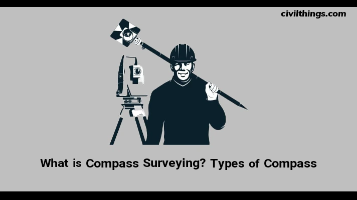
What is Compass Surveying?
Compass surveying is an important branch of surveying which is usually adopted in determining the position of an object both by angular and linear measurements. Here angular measurements are taken using a compass and linear measurements are determined using chain or tape.
Some priorities for compass surveying are:
- If there is a large area to be surveyed such as the coastal areas or the course line areas of the river.
- If the area is crowded with many details and has many obstacles for conducting chain surveying as triangulation becomes impossible.
- If the surveyor has a specific time limit for conducting the surveying on a large and detailed area.
But there are also some limitations to compass surveying. It is not recommended for the areas that are avoiding public attention and have the presence of iron ore deposits, magnetic substances like metallic or steel structures, electric cables conveying current, etc.
Types of Compass
Magnetic Compass
The magnetic compass is a compass having a magnetized needle in line with the magnetic poles of the earth.

Prismatic Compass or Lensatic Compass
Prismatic or lensatic compasses are used for lining up with an object whose bearing is to be determined. A prismatic compass has a glass prism or a lens and a lid with a hairline. This type of compass often has a magnifying lens for map reading, some sort of light for low light conditions, and a ruler. It is often used for military purposes or plotting.
Surveyor’s Compass
It is an instrument used frequently by surveyors for measuring horizontal angles and also for determining the magnetic bearing of a line of sight. The compass consists of a pivoted magnetic needle, a graduated horizontal circle, and a sighting device.

Liquid Compass
It is a type of compass in which a magnetized needle or dial and the compass card rest on a pivot inside a capsule that is completely filled with liquid. Mineral oil, lamp oil, ethyl alcohol, white spirits, or purified kerosene are commonly used as the liquid.

Marine Compass or Card Compass
This type of compass has a needle that is fixed and a compass card that is mounted in fluid and rotates according to orientation. It is used on boats because the moving card absorbs much of the motion of a boat which makes it easier to read than a needle compass.

Baseplate Compass or Orienteering Compass
Baseplate compass or orienteering compass is a liquid-filled compass that is placed on a rectangular base made of transparent plastic so a map can be read through it. It usually a magnifying lens for map reading, some sort of light for low light conditions, and also a ruler.

Thumb Compass
Thumb compass is a type of base plate compass but smaller. It is fixed on the thumb as its name says and that is which it leaves one hand free. This type of compass is commonly used in orienteering, a sport in which map reading and terrain association are paramount.
Solid-state Compasses
Solid-state compasses are mainly found in electric devices. They often have two or three magnetic field sensors from which microprocessor reads data about the orientation of the device. They are usually used in clocks, mobile phones, and tablets.

Qibla Compass
Qibla compass is used by Muslims to identify the direction to Mecca, so they would know the direction to face while praying.

GPS Compass
The full form of GPS is the Global Positioning System. The compass that uses satellites in a geosynchronous orbit over the Earth to show the exact location and direction of the movement of the bearer is called a GPS compass.

Gyro Compass
A Gyro compass is a form of gyroscope, used widely on ships employing an electrically powered, fast-spinning gyroscope wheel and frictional forces among other factors utilizing the basic physical laws, influences of gravity and the Earth’s rotation to find the true north.

Astro Compass
An astrocompass is a navigational tool that uses the positions of various astronomical bodies to determine the direction of true north. It is mainly used in polar regions where magnetic compasses and gyrocompasses are unreliable. It uses current time and geographical position in the form of latitude and longitude.
Compass Surveying in Detail
Magnetic Compass Surveying
Application: Determines magnetic bearings of a line. Bearings measured in Whole Bearing System (WBS) or Quadrantal Bearing System (QBS).
Prismatic Compass Surveying
Application: Used for lining up with objects to determine their bearings. Equipped with a glass prism, lens, hairline, magnifying lens, and often used for military or plotting purposes.
Surveyor’s Compass Surveying
Application: Measures horizontal angles and magnetic bearings. Consists of a pivoted magnetic needle, a graduated horizontal circle, and a sighting device.
Liquid Compass Surveying
Application: Compass card and needle float in liquid for stability. Common liquids used are mineral oil, lamp oil, ethyl alcohol, white spirits, or purified kerosene.
Marine Compass Surveying
Application: Stable compass ideal for boats. Needle is fixed, and the compass card rotates in fluid.
Baseplate Compass Surveying
Application: Liquid-filled compass on a transparent base for map reading. Features magnifying lens, light for low conditions, and a ruler.
Thumb Compass Surveying
Application: Compact baseplate compass fixed on the thumb. Used in orienteering for map reading and terrain association.
Solid-State Compass Surveying
Application: Utilized in electronic devices. Employs magnetic field sensors and microprocessors for orientation data.
Qibla Compass Surveying
Application: Aids Muslims in identifying the direction to Mecca for prayers.
GPS Compass Surveying
Application: Utilizes satellites to provide precise location and direction.
Gyro Compass Surveying
Application: Uses a fast-spinning gyroscope wheel and physical laws for navigation on ships.
Astro Compass Surveying
Application: Navigational tool using astronomical positions for accurate readings. Particularly useful in polar regions.
why traffic Study is important ✅
Conclusion
Compass surveying, with its diverse types of compasses, serves as a crucial tool in determining positions, angles, and distances in various surveying scenarios. Each type of compass has its unique features, applications, and advantages, making them suitable for specific surveying needs. A comprehensive understanding of these compasses is essential for surveyors, navigators, and individuals working in related fields.

Hi! I’m Sandip, a civil engineer who loves sharing about Civil Engineering & new ideas and tips. My blog helps you learn about engineering in a fun and easy way!
Comments are closed.